


Visualizing point cloud data across the asset life cycle
AVEVA Point Cloud enables surveyors, engineers and asset owners to bring 3D laser scanning data together and collaborate on a single data source. Information captured in this way can be shared and used by data stakeholders throughout the asset life cycle.
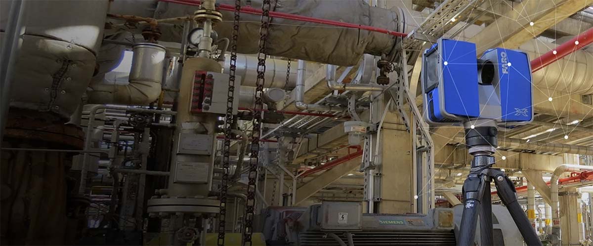
Over the life cycle of an asset, gaps appear between what engineering plans show and the actual as-built condition. Surveying with laser scanning and other 3D data capture devices, such as handheld and UAV, closes this gap by providing an accurate picture of the as-built asset.
Using AVEVA Point Cloud, access a reliable digital asset without having to physically visit the site and create pinpoint accurate deliverables by integrating as-built data into 2D drawings and 3D models. Save time, cut costs and reduce risk with minimized rework, less site visits and higher accuracy.
Simple, Accessible and Secure
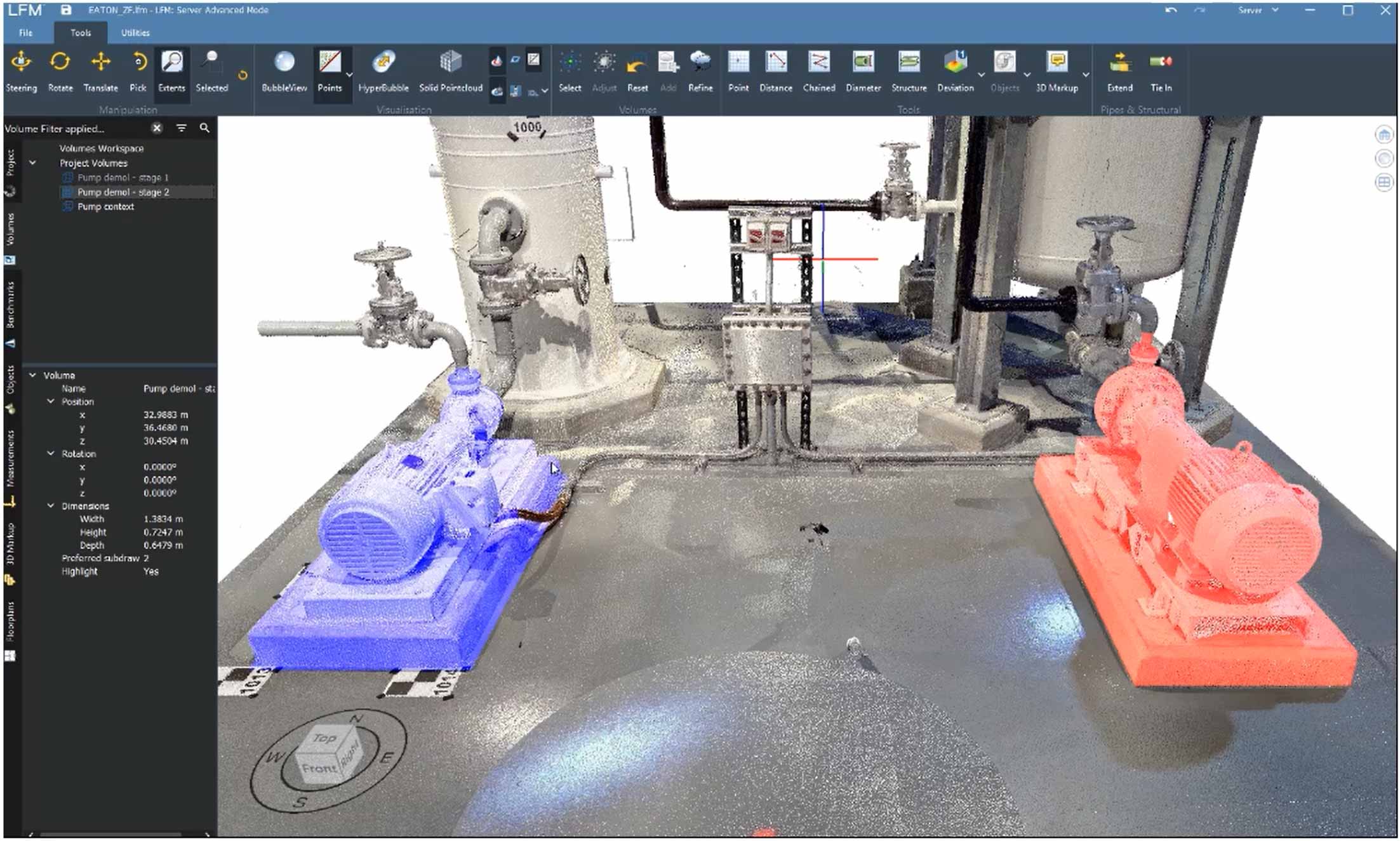
Validation and visualization
- BubbleView™ – access a scanner’s eye view of your data. Make precise measurements, add intelligence
- HyperBubble™ – fly through BubbleViews meshed together into a 3D landscape
- Solid Pointcloud™ – a low-hardware way of rendering point cloud data into visually solid surfaces. This allows user to understand an entire site on-screen at once, then dive down deeper into an area of interest
- Access point cloud data from mobile devices
- Take data offline when network connections are unavailable
- Smart tools validate data automatically as you add to your dataset
- Registration validation – check error values and use traffic light system for customised thresholds
- Automatic Clash Detection against existing 3D models
- Tag locations with intelligent data such as labels and links to documents within the point cloud model
- Zoning – identify units and areas
Data management
- Identify and focus on high value areas
- Hide unwanted data
- Keep data alive by incrementally updating your dataset with new scans
- Data is never gone forever – always retrievable
- Apply conversion options based on range, intensity and mask-mixed pixel
- Offload storage and computational power to cloud services
- Access via the AVEVA Connect platform for easy access and management of users in a secure data environment
- Also available on premises or your own cloud
Integrate CAD
- Bring CAD objects into your point cloud dataset from compatible packages
- Finding project tie-ins to help drive engineering decisions
- Semi-automatically create as-built 3D CAD models from as-built data
- Model pipes and structural standards from the standards library
Proven solution, proven results
- Provide a real-world environment across multiple entities for sharing and accessing information
- Increase the speed and accuracy of decision making by contextualizing information
- Improve safety and minimize costly shutdowns by reducing time spent on site.
- Reduce project timescales during the design and construction phases by up to 80% and 20% respectively.
- Reduce project rework to less than 1% by engineering in an accurate, immersive environment.
- Reduce the cost of capturing as-built information by up to 80% over traditional methods.
AVEVA Point Coud Compatibility
AVEVA Point Cloud enables you to register, process and visualize point cloud data across the life cycle of your asset. Data can be imported from any device and exported downstream in a variety of CAD applications.
Scan Hardware
- Z+F – .zfs
- FARO – .fls
- Leica – .ptz, .ptx, .zfs, .prj
- Riegl – .rxp, .rsp .3DD
- Trimble – .tzf, .ptx, .fls
- Topcon – .cl3
- DotProduct
- Other formats – .pts, .las, .laz & more..
CAD Software
- AVEVA E3D Design
- Hexagon PPM
- Autodesk
- Bentley
- Others
Visualize and make measurements with confidence from anywhere in the world, validate as-built condition against engineering plans to ensure data integrity and minimize risk and reduce costs associated with onsite visits.